


Hike Report - White Pines Nature Preserve tree identification hike
Nov 24 hike sponsored by Grand Trees of Chatham
Up front, I admit I have a long way to go in identifying trees. But it was all the same a very enjoyable hike!
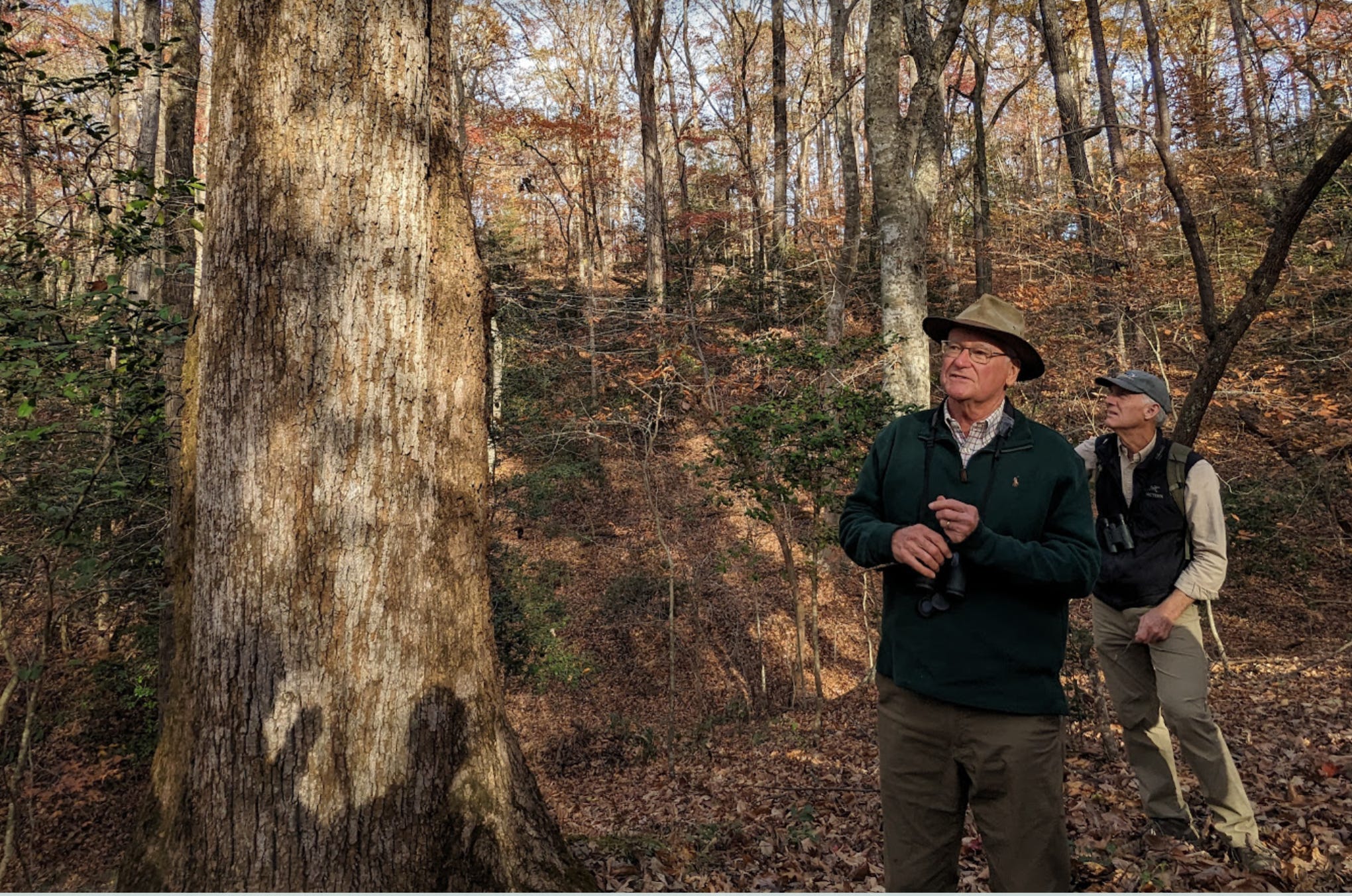
We met at the first/main parking area (the first P in the map below, on the Shiner’s Way trail). There were 15 or so attendees, plus hike leaders Don Pelly and Rouse Wilson.
Our first tree was the loblolly(s) bushed in the middle of the parking and standing tall all around. Yes, a dime a dozen. Don explained that loblolly’s Latin name is pinus taeda which he encouraged us to remember by (roughly) rhyming it with “hot potato,” as in you can’t grip a loblolly pinecone, due to its spines, any more than you would a hot potato. (More about my journey into pine tree identification here)
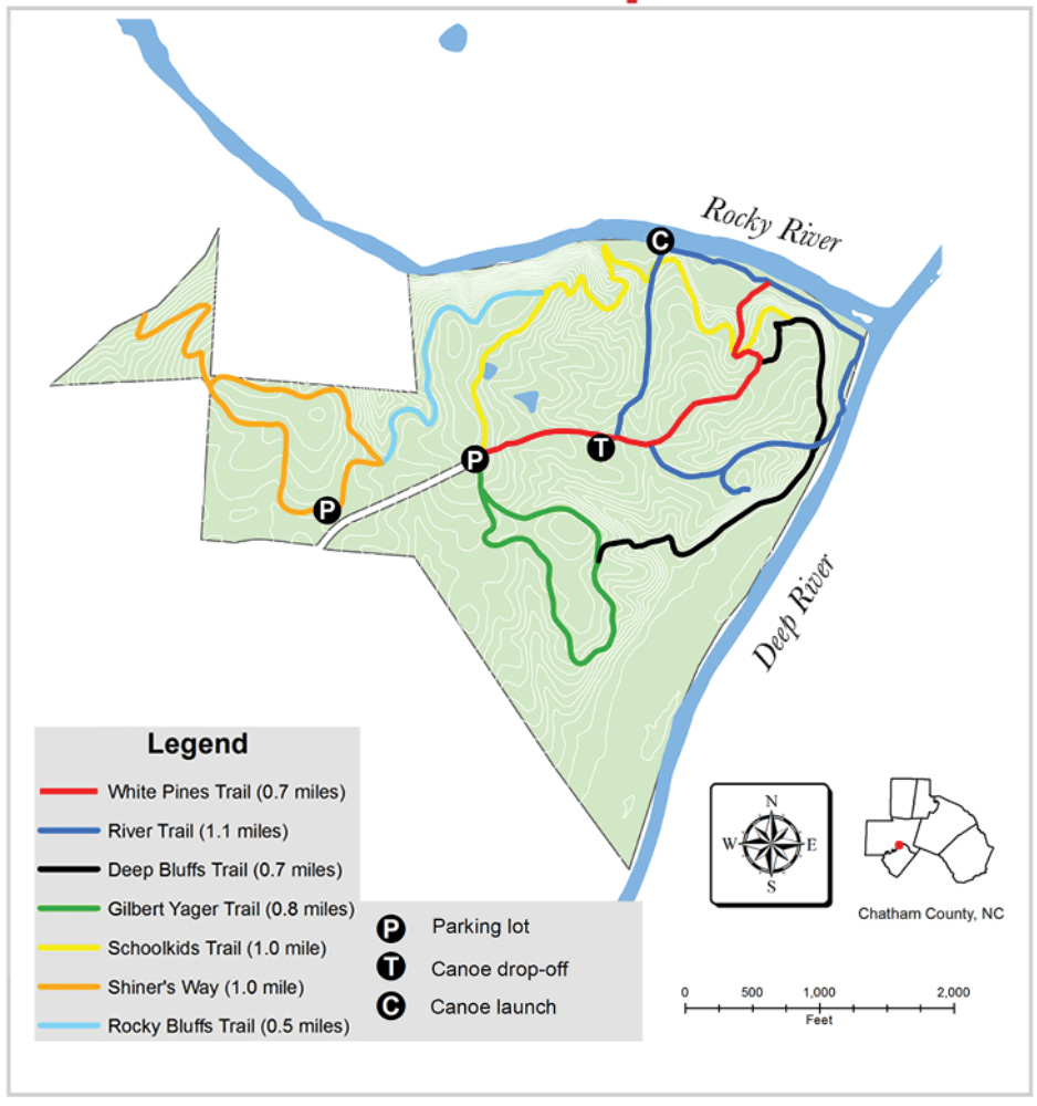
We proceeded down the Shiner’s Way trail a short distance to the Rocky Bluffs trail, on which we spent most of the hike. Along the way we learned about white oak, white pine, sugar maple, hickory, ironwood, sour wood, black cherry, and more.
At the river, we observed river birch and sycamore. We also learned about the Schoolkids Trail, so named for a trail used by children to get to school. Years and years ago, we heard, Black families lived in the area of the preserve, but they did not have access to a school. The state told them they didn’t have enough numbers to warrant a school. They teamed up with families living across the river by building a cable bridge across the river where the Schoolkids Trail meets the water. The rusted metal cable is still piled there, to this day.
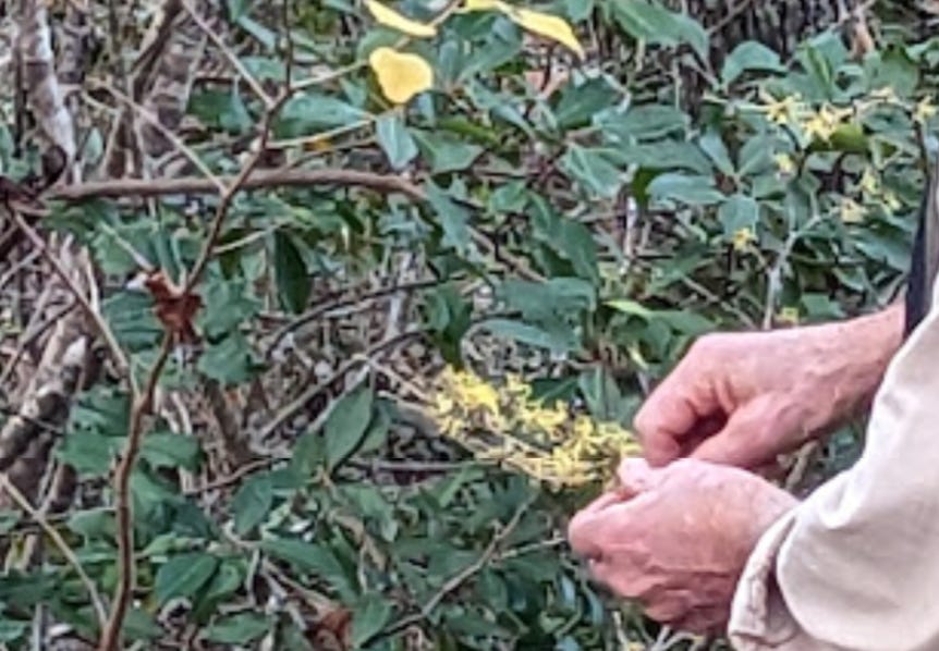
One very cool find of the day was witch hazel. It’s better known to be found in the mountains, but there is a small stand of it growing on the north slopes of the preserve, along the Rocky River, where the Schoolkids trail meets the River Trail.
We eventually wound our way up the River Trail to finish the hike. As we neared the end, our hike leaders led us off the trail to the north, to highlight a little-known graveyard in the woods. Easy to miss, the headstones are worn, rectangular upright stones with no markings, no more than a foot tall, most less than that. The graves themselves are identifiable by the pattern of 6-foot long depressions in the ground, in a row. They are oriented roughly northeast-to-southwest.
Don and Rouse brought a great energy and incredible knowledge to the hike. They love what they do and love to share and educate. I came to the hike with a particular interest in learning about pines, which they certainly helped further. And they piqued my interest by mentioning the rare longleaf pine that they knew was in the preserve. Rouse said they knew for sure where to find one of them along the Gilbert Yager Trail, and they’d heard of another but didn’t know where it was. This inspired me to return another day - check out “Our local pines” for more!
